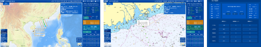
Marine Survey Operation Management Platform The Marine Survey Operation Management Platform is a collaborative system specifically designed for marine scientific research, featuring four core functional operation modes:
1.Full-Ship Information Tracking: Integrates Beidou/GPS data to display the ship's real-time position, speed, and trajectory. It supports historical playback and abnormal warning.
2.Diversified Station Management: Assists in planning and displaying scientific research stations, marks key data such as geology and hydrology, and optimizes sampling schemes based on station tasks.
3.Multi-Source Equipment Monitoring: Synchronously displays temperature, salinity, depth (TSD) and image data collected by equipment such as CTD, ROV, and winches. It supports threshold alarm and remote control.
4. Cross-Terminal Collaboration: Real-time sharing of operation progress across multiple terminals, enabling the entire process of task assignment and data management to be online. The system has supported the operations of research vessels such as the "Xuelong Series" and "Experiment 6", effectively improving the informatization level of scientific research operation management.